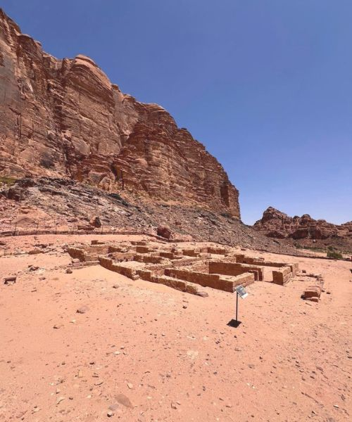
Wadi Rum Attraction
Where every mountain, canyon
and stone tells a story.
A researched guide to eighteen landmarks across the Wadi Rum Protected Area — with sources for every claim, real photographs for every site, and honest notes where reliable information is scarce.
I I CANYONS & SIQS
I I I HISTORY & ARCHAEOLOGY
I V DESERT LANDSCAPES
V MOUNTAINS & VIEWPOINT
I.
Chapter · Rock Bridges
Arches carved
by wind, and time.
Wadi Rum’s natural arches were formed over roughly 500 million years, as Cambrian sandstone eroded along vertical joint planes. Only a handful are large and accessible enough to visit.
I.01 Burdah Rock Bridge
Burdah Rock Bridge

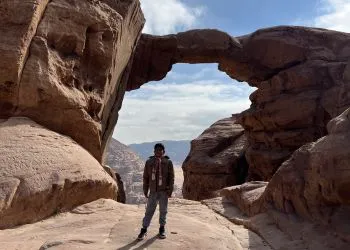
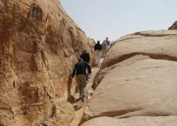
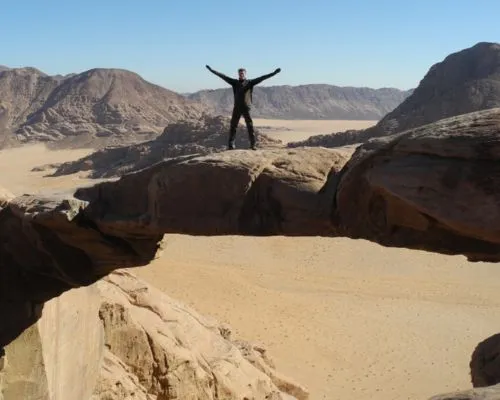
Set high on the flank of Jabal Burdah in the southern reserve, Burdah is Wadi Rum’s largest freestanding arch — its span is quoted at around 35 metres, standing roughly 80 metres above the desert floor once you factor in the approach. The route begins with a 4×4 transfer, followed by a steep slickrock scramble with two exposed chimney sections that most parties choose to protect with a rope.
“You can stand on the arch itself and look out across open desert in every direction — the reward for the hardest hike on this list.”
Half to full day · 1–2 h ascent·Strenuous · exposed scrambling, rope recommended·October–April · early morning·Southern reserve · Jabal Burdah
Jeep tours — No · dedicated trip required
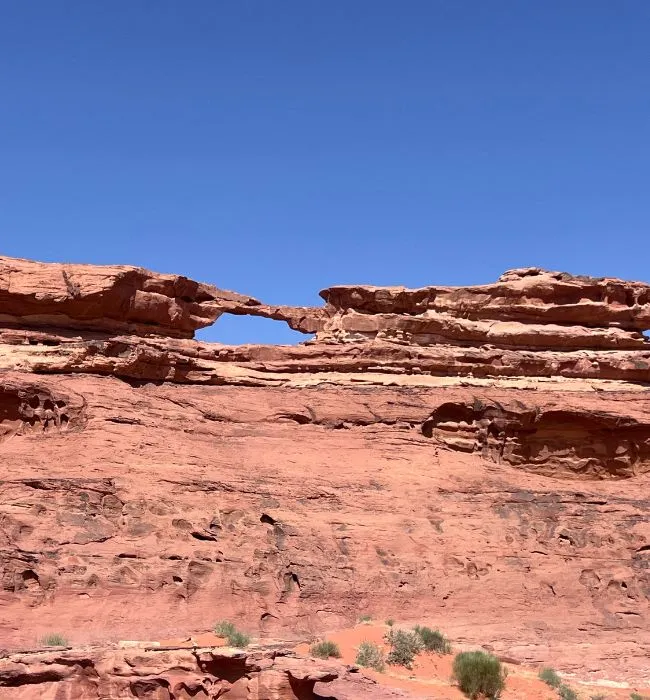
Umm Fruth Rock Bridge.
A free-standing arch estimated at 15 metres high, reached by a short but steep scramble up its flank. Because it sits alone on an open plain rather than atop a massif, Umm Fruth is the arch that appears in most Wadi Rum photography, and the only one that visitors of average fitness can climb without a rope.
The most photographed silhouette in the reserve, and structurally rare — a true free-standing bridge with no cliff support on either side.
30–60 min · with jeep transfer·Moderate · short exposed scramble·Late afternoon · low sidelight·Central reserve · south of Khor Al-Ajram
Jeep tours — Yes · standard jeep stop
03
I.03 · a quieter stop
Little Rock Bridge (Raqabat Al-Wadak)
A modest arch — roughly 4 metres above its base, 7 metres above the valley floor — set close to Khor Al-Ajram, the junction of Wadi Rum’s main valleys. Its central location makes it a standard first stop on jeep circuits, and its low height lets almost anyone climb up and stand on top.
15–30 min · jeep photo stop·Easy · walk-up·Late afternoon · sunset·Central reserve · Khor Al-Ajram junction
Field note
Not to be confused with the Rock Bridge of Kharaz, a separate 34-metre arch located outside the main Protected Area near Al-Quwayra. The two are frequently conflated online.
II.
Chapter · Canyons & Siqs
Narrow corridors of shade and stone.
Seasonal floods and joint-line erosion have cut a series of narrow passages — siqs — through Wadi Rum’s massifs. The best of them combine cool shade, dramatic geology and ancient rock art.
Jeep tours — Yes · standard jeep stop
Khazali Canyon
A narrow, roughly 100-metre-deep fissure splitting the flank of Jabal Khazali. Its walls carry Thamudic, Nabataean and Islamic inscriptions alongside petroglyphs of ibex, camels, human figures and enigmatic foot-sole carvings — first formally recorded by the French epigraphists Antonin Jaussen and Raphaël Savignac in the early 20th century.
One of the two most important rock-art panels in Wadi Rum, and the easiest place in the reserve to see inscriptions from three distinct civilisations in one short walk.
Khazali Canyon is a narrow canyon in Wadi Rum known for ancient inscriptions and petroglyphs from the Nabataeans and Thamud. The carvings show people, animals, and early scripts, making it a popular stop on Wadi Rum jeep tours.
II.02
Abu Khashaba Canyon
Abu Khashaba Canyon
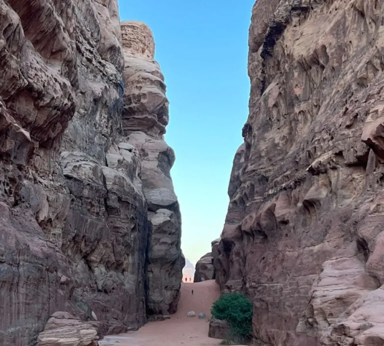
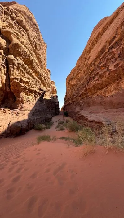
A slender slot canyon cutting north through Jabal Khashaba, wide enough at the floor to walk comfortably but tall and narrow enough overhead to feel cathedral-like. Wind-blown sand fills the base and rare acacia trees have taken root along its length, fed by runoff that collects between the walls.
The best place to see the aeolian cross-bedding of Wadi Rum’s Cambrian sandstone at eye level — 500 million-year-old wind patterns preserved in stone.
“One of the few canyons in the reserve that most visitors walk through end-to-end rather than just look at from outside.”
30–50 min · through-walk·Easy · flat sandy floor·Midday · natural shade·Northern reserve · Jabal Khashaba
Jeep tours — Optional add-on
III.
Chapter · History & Archaeology
Where the desert remembers.
Wadi Rum holds over 25,000 petroglyphs and 20,000 inscriptions, ranging from Neolithic hunting scenes to Nabataean shrines and early Arabic script. The following four sites are the most visitable — and the most historically substantive.
III . 01
An annotated plate
Lawrence's Spring (Ain Shalaaleh)
45–90 min · 2 km return from the village·Easy to moderate · marked path with steps·Morning · shaded approach·Rum village · west flank of Jabal Rum
A perennial freshwater spring on the west flank of Jabal Rum, known in Arabic as Ain Shalaaleh — the ‘spring of the waterfall’. Nabataean rock-cut aqueduct fragments survive on the slope below, and one nearby inscription dated to the reign of Rabbel II (r. 70–106 CE) records the ancient place-name of Wadi Rum: Iram. T. E. Lawrence described climbing to it in Chapter LXIII of Seven Pillars of Wisdom, though the spring predates him by two millennia.
A rare year-round water source in the desert, and one of the few places to see Nabataean hydraulic engineering surviving in the landscape rather than a museum.
III . 02
Lawrence's House
Lawrence's House (Al Qsair)
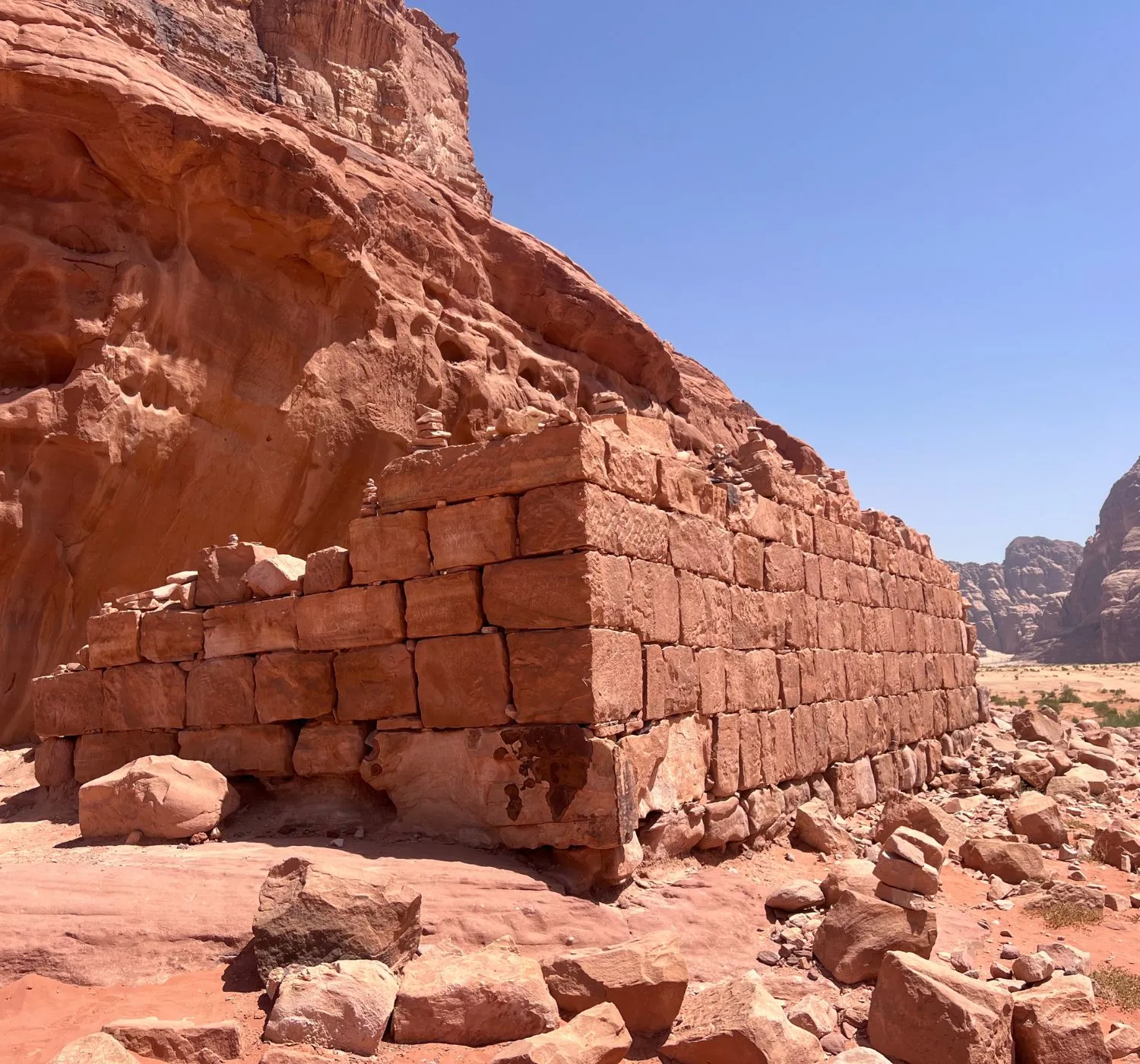
A ruined single-storey structure built on Nabataean foundations, its walls partly assembled from re-used inscribed stones. Local Bedouin tradition holds that T. E. Lawrence used the building during the Arab Revolt of 1917–18; there is no primary documentary record confirming that association. What is securely dated is the site’s Nabataean-era phase as a wayside station on the caravan route north from the Hejaz.
A concrete link between the two overlapping stories that shape Wadi Rum’s modern reputation: the Nabataean trading world, and the desert campaign of the First World War.
15–30 min · jeep photo stop· None · ground-level ruin·Late afternoon · faces west onto red dunes·Central reserve · edge of the red-dune plain
Jeep tours — Yes · standard jeep stop
Field note
The ‘Lawrence’ attribution belongs to living Bedouin oral tradition and was popularised further by David Lean’s 1962 film. It is a real local tradition, but not a documented historical fact. The Nabataean foundations underneath are the site’s securely dated layer.
03
III.03 · a quieter stop
Nabataean Temple (Temple of Allat)
A peripteral temple at the foot of Jabal Rum, built in the late 1st century BC to early 1st century AD under the Nabataean king Aretas IV. Its primary phase comprised a stone podium supporting a 3.2 × 2.7-metre naos surrounded by fourteen stuccoed columns. A Thamudic inscription re-used in its foundation refers to an earlier sanctuary of the goddess Lat, from whom the temple takes its modern name.
20–40 min · walking distance from the village·None · open-air ruin·Morning · east-facing entrance·Rum village · foot of Jabal Rum
Jeep tours — Yes · standard jeep stop
III. 04 Anfishieh Inscriptions
Anfishieh Inscriptions
Jeep tours — Yes · standard jeep stop

A tall rock panel on the south face of Jabal Anfishieh crowded with Thamudic and Nabataean inscriptions alongside petroglyphs of camel caravans, ibex and human figures. Field studies by Saba Farès and the Wādī Ramm epigraphic project have dated much of the panel to roughly 2,000 years old, with Thamudic layers likely older still.
“Because you can trace an entire pre-Islamic caravan scene — camels, drivers, tribal marks — laid down 2,000 years ago in the same rock face.”
10–15 min · jeep stop with short walk·Easy · viewable at ground level·Morning or late afternoon · soft raking light·Central reserve · south face of Jabal Anfishieh
IV.
Chapter · Desert Landscapes
The desert's own architecture.
Wadi Rum’s landscape is layered — vivid red iron-oxide sands in the north, pale quartz plains in the south, and pedestal rocks and dunes that have become the desert’s public sculptures.
IV. 01 Red Sand Dune
Red Sand Dune

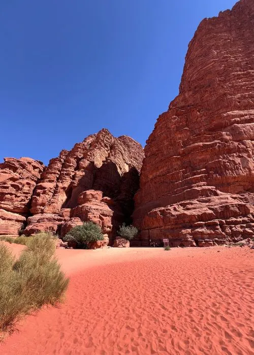
The most-visited dune in Wadi Rum — locally called Al Hasany — banked against the cliff wall of Jabal Umm Ulaydiyya. Its deep red comes from hematite, iron oxide coating each quartz grain, the same mineral that colours the surrounding sandstone. It is a barchan-type dune shaped by prevailing northwesterly winds.
“The contrast of a red dune against a black-shadowed cliff at sunset is Wadi Rum’s most-photographed composition — and it earns the reputation.”
Jeep tours — Yes · standard jeep stop
IV. 02
The White Desert
The southern half of the reserve is another desert entirely. The Rum sandstone here contains far less iron, so the sand and low escarpments read as pale yellow, cream and lavender rather than red. Wadi Sabet is its main east–west corridor. It sees a fraction of the visitors the northern desert does.
The mineralogical counterpart to the red north — evidence that Wadi Rum is not one landscape but at least two, meeting along a subtle geological boundary.
Half to full day · dedicated southern circuit·Easy by 4×4·Sunrise and sunset · pastel colour shifts·Southern reserve · Wadi Sabet region
Jeep tours — No · dedicated trip required